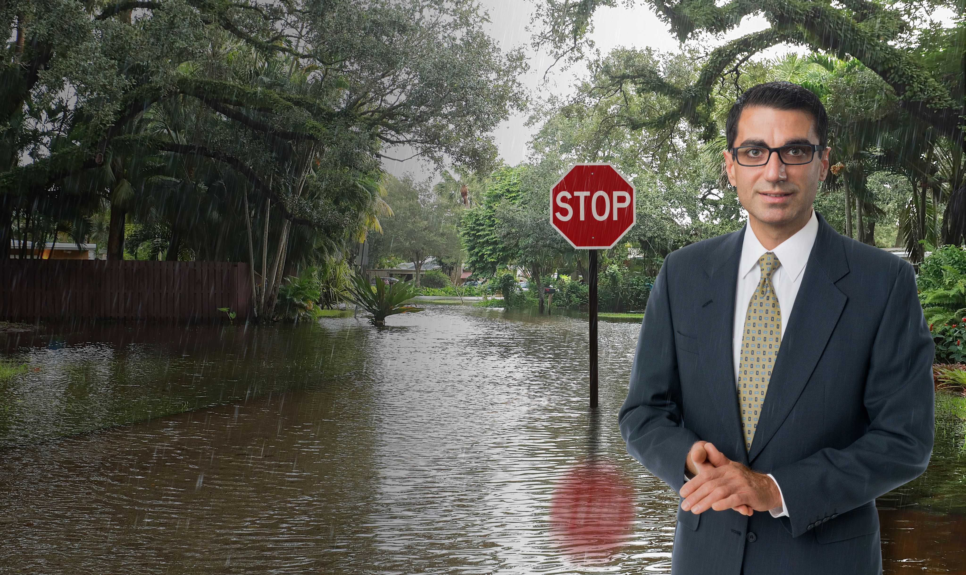
Stop.
Gather Critical Information.
Proceed.
A simple, innovative idea to provide real-time flood data

Flooding tops the list of natural hazards in the United States and many parts of the world.
However, in an age when reams of data about almost everything are readily available, real-time flooding data and analysis still remains mostly a concept to first responders and the public, said Amir Behzadan, professor of construction science at Texas A&M University, who is developing a new system to collect, curate, and communicate this kind of data. Flood data gathering measures in many neighborhoods are very basic — if they exist at all, he said.
“There are flood gauges that are operated by the U.S. Geological Survey or local governments, but these have limited coverage and do not provide the full picture of how floodwaters move, especially in residential neighborhoods,” he said. “In Houston, some areas have buoys or gauges in rivers and creeks, but those only register conditions close by.”
More imprecise methods are used for large areas that don’t have these devices.
“As you move farther away from the small number of flood gathering devices we do have, you have to rely on modeling that uses hydrological equations and other mathematical techniques. Many times, these techniques are inaccurate because floodwaters’ movement depends on many variables, such as characteristics of the terrain it’s on, which affects how much water is being absorbed and how much of it runs off,” he said.


A RESEARCH IDEA HAPPENED IN A ‘FLASH’
Behzadan, whose research aims to enhance the interface of artificial intelligence and the built environment, wondered how real-time flood data could be much more accurately gathered, analyzed, and widely distributed. As he pored over flood photos online, an idea came to him: what about an artificial intelligence-based solution that involved a standard unit of measurement that’s a common sight in neighborhoods everywhere...


The stop sign?


“In a way, it’s really a very simple concept,” said Behzadan, who is heading the project with collaborators Michelle Meyer, director of the Hazard Reduction and Recovery Center, Courtney Thompson and Zhe Zhang, Texas A&M assistant professors of geography. The project is funded with a grant from the Texas Sea Grant Program from the U.S. Department of Commerce National Oceanic and Atmospheric Administration.
The system that Behzadan and his collaborators are developing works with data that can easily be captured in a flooded area.
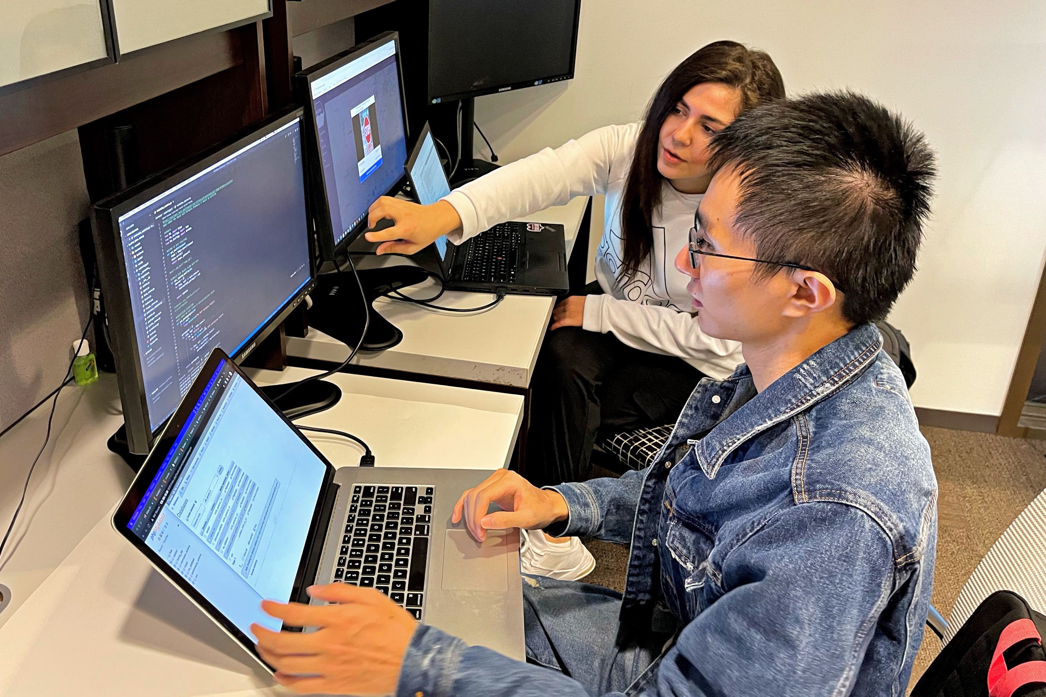
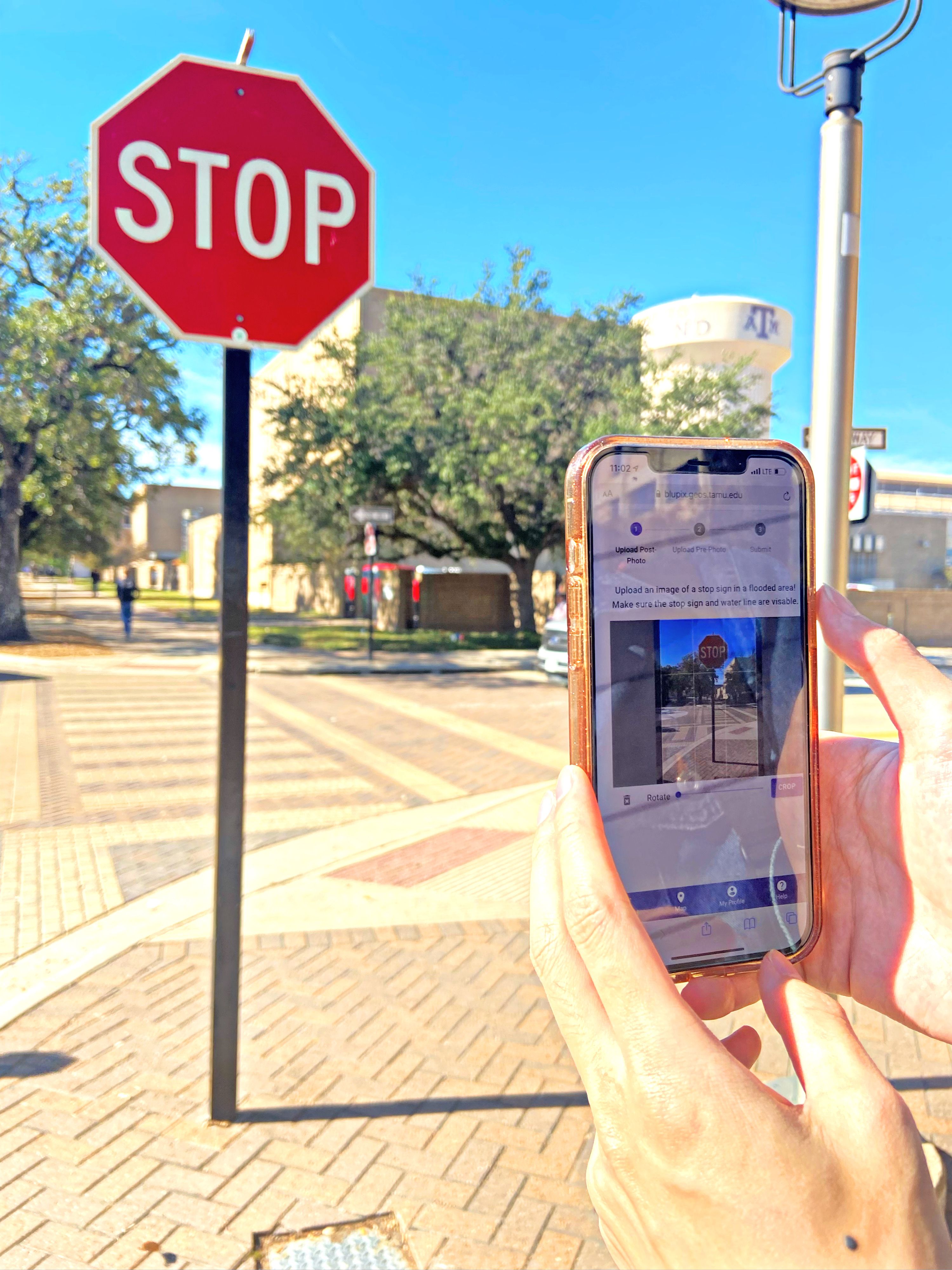
When floodwaters strike, a resident would merely need to take a photo of the floodwaters at a stop sign with a mobile phone and upload it to Blupix, an online crowdsourcing platform that is also developed by the research team.
An artificial intelligence model that Behzadan and his collaborators are creating will compare the submitted floodwater photo with an existing Google Street View image of the same location, and, using the stop sign’s size as a measurement benchmark, estimate the depth of floodwaters in the location of the depicted stop sign.
Because the signs have a standardized 30” diameter, the pre- and post-flood photos don’t need to be from the exact same angle or time of day; the model will be able to recognize different angles and account for them as it provides the floodwater depth information.
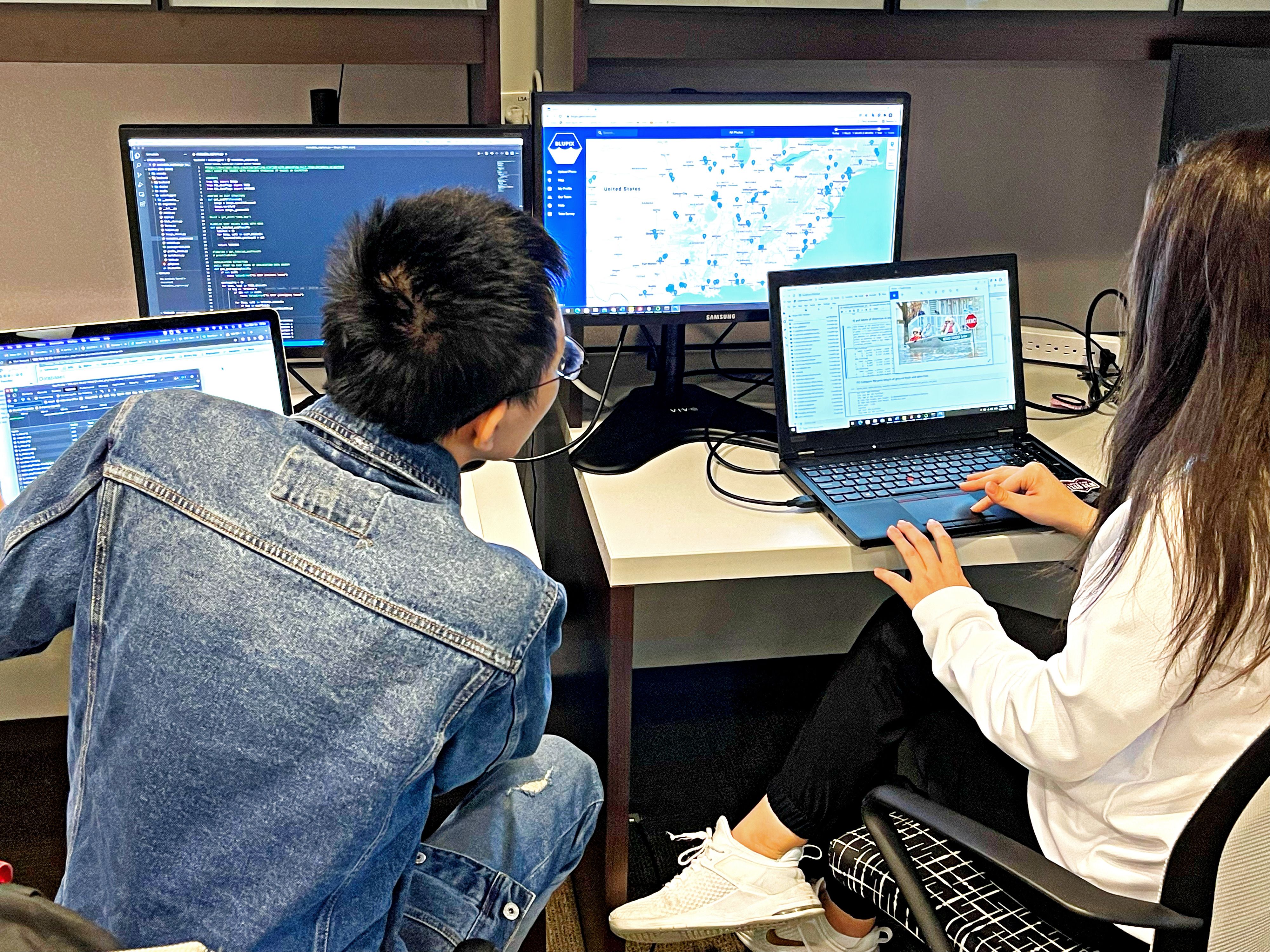
“The application also provides a mapping interface so the floodwater information can be communicated in real time to the public, first response teams, and authorities,” said Behzadan.
He envisions the popularity of posting photos to social media sites as an aid to help dramatically improve flood data gathering.
“When you think about it, how many smartphones and tablets are out there, where people post photos on social media for the fun of it?” he asked. “Imagine these devices turning into flood data collection devices,” he said. Focusing on stop signs makes the concept understandable to everyone, said Behzadan.
“Stop signs are everywhere,” he said. “Even a very young child would be able to find a stop sign in their neighborhood, but if you asked someone to locate a nearby flood gauge they very likely wouldn’t know.”
In Bryan/College Station area, there only a few USGS-operated flood gauges. “But how many stop signs are there?” asked Behzadan.


A POTENTIALLY LIFE-SAVING PROJECT
A system with real-time flooding information could save lives, he said.
“When a hurricane strikes or there’s a flooding event, the majority of people who lose their lives aren’t those who are directly affected by the hurricane or by rainfall-related flooding,” said Behzadan. “It’s people who are driving or walking on flooded roads.”
These are ordinary people, he said, that don’t know that lethal floodwaters could be 50 or 100 feet in front of them.
“We’re working on providing this kind of life-saving information in real time, so that everyone, from first responders to the general public, will know where and when flooding is occurring,” he said.
HOW HIGH IS THE WATER?
The level of floodwaters is also vital information to first responders, who need precise information to make decisions about rescues.
“You ask five different people in the same apartment complex, how high did it flood? You will get five different answers,” said Matthew Marchetti, co-founder of Crowd Source Rescue, one of the nonprofit organizations collaborating with the Texas A&M researchers. “Is the floodwater two feet, is it six feet? There’s a big difference between those two numbers, because it’s the difference between a truck and a boat,” he said.
“At the end of the day it helps save more lives, if we can get first responders better and faster information,” Marchetti told KHOU- TV in a story about Behzadan’s project.
The crowdsourced photos could also help increase the accuracy of floodplain maps, while reducing the time it takes to update them, particularly in areas where less flood data has been historically collected, said Behzadan.
“FEMA flood maps are widely used to determine flood risk, vulnerability, and insurance cost,” said Behzadan. “But the process of creating and updating these maps is very complex. 75 percent of these maps are older than five years, leaving many U.S. communities with no or outdated flood maps.”
Behzadan believes the crowdsourced flood data concept, when it’s “up and running,” could be particularly helpful in underserved areas, most of which lack even rudimentary flood data gathering measures.
“Many of the communities that are flood prone in Houston, Galveston or Port Arthur are underserved to begin with and don’t have the same level of flood mitigation infrastructure that other communities do,” he said. “These are often communities of color, some of which have large immigrant populations, and they are often disproportionately affected by flooding.”
To spread the word about the project, Behzadan is working with organizations in the Texas Gulf Coast region that work in underserved communities, attending meetings and explaining the simple way for members that live in these neighborhoods to help bolster real- time flood data collection where they live.
“The more photos that are uploaded to the site from these communities, the more accurate the flood data gathering will be,” said Behzadan.
“Stop signs are everywhere. Even a very young child would be able to find a stop sign in their neighborhood, but if you asked someone to locate a nearby flood gauge they very likely wouldn’t know.”


Photo by Jonathan Cooper on Unsplash
Photo by Jonathan Cooper on Unsplash
“Many of the communities that are flood prone in Houston, Galveston or Port Arthur are underserved to begin with and don’t have the same level of flood mitigation infrastructure that other communities do,”

